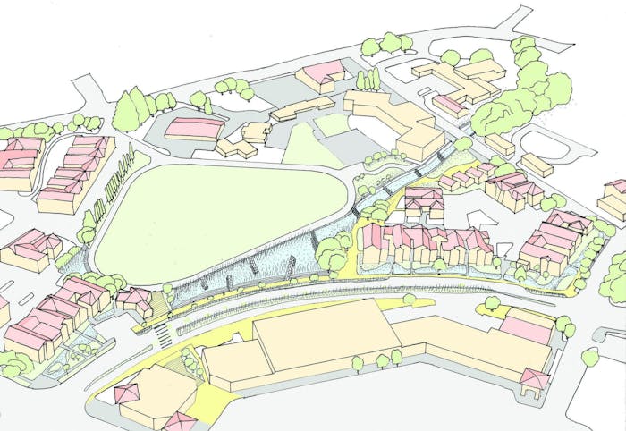
Marin City is a bowl at the base of the Richardson Bay watershed area, sandwiched between San Rafael and Sausalito north and south, and Richardson Bay and the Golden Gate National Recreation Area headlands east and west.
Deeply eroded gullies, severely paved culverts, and inadequately sized pipes drain the watershed causing chronic serious flooding events. Sediment and debris often clog this infrastructure and have silted the only retention basin exacerbating the problem. Low lying pinch points and limited transportation corridors hamper ingress and egress during this inundation. Extreme events can inundate Highway 101 causing regional transportation breakdowns on the only road and major commuter corridor connecting Marin City to the rest of the county. Of greater impact locally, the one road in and out of the community, Donahue Street, is regularly flooded and closed more frequently.
Chronically marginalized communities find themselves on the front lines of sea level rise with inadequate infrastructure, inequitable resources, and the imminent threat of displacement along with enduring stressors like food insecurity. Even well-intended municipal planners, designers, developers, and regulators can be seen as outsiders. The normal process of assess, ideate, engage, iterate, then present overlooks the community’s capacity to generate or express their own self-determined solutions.
Source: Resilient by Design | Bay Area Challenge

 03 Good Health and Well-being
 09 Industry, Innovation and Infrastructure
 11 Sustainable Cities and Communities
 13 Climate Action